Use Search engine below to find more pages.
|
THE WEB CHARMOUTH SITE |
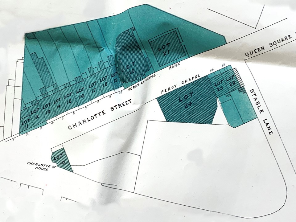
Click on 21 Charlotte Street to find out more about this fascinating property.
Click on Charlotte Street Area History to find out more about it.
Maps
of the Charlotte Street Area in Bath from 1600 to date are shown below.
Maps
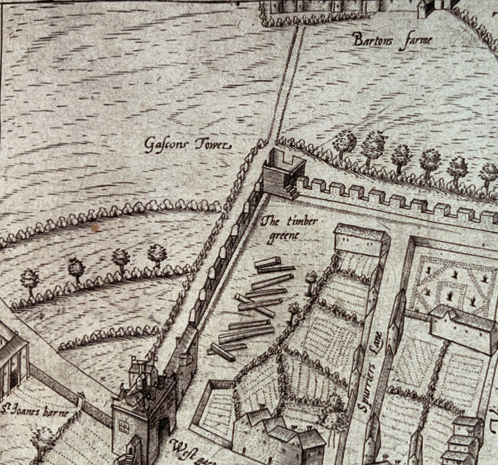
of Bath by Savile c.1600 with Barton Farm buildings outside the City Walls. The farm house was at the rear of Jolly`s Department store in John Street.
.jpg)
.jpg)
.jpg)
Buck`s Prospect of Bath in 1734 shows Queens Square in the centre in an unfinished state looking on to fields.
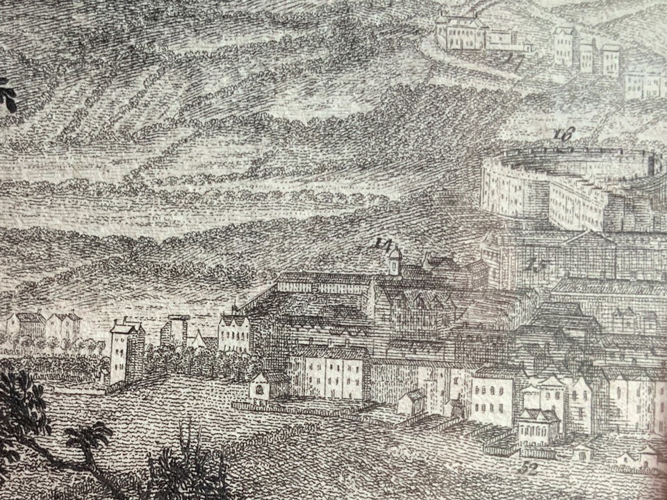
A South West Prospect of Bath, 1757 by Thomas Robins showing The Circus (no.16), Queens Square (no. 15), Queen`s Square Chapel (14), Printing Office (no.52) and the land in front as fields
Map
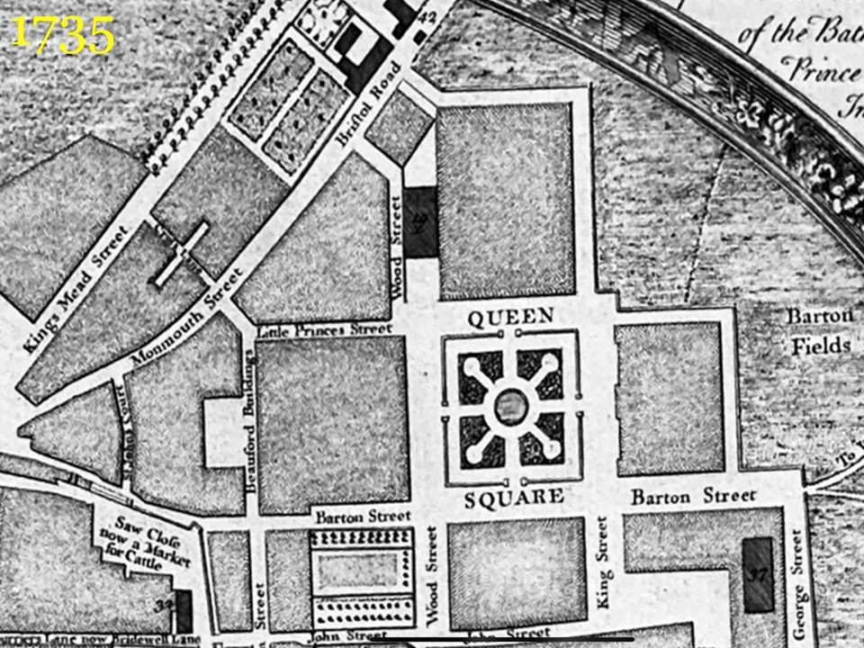
of Bath 1735 by John Wood showing the Turn Pike Gate (no.42) at the Kings Arms in Monmouth Place adjoining Charlotte Street.
A Plan of the Parish of Walcot surveyed by Thomas Thorpe in 1740
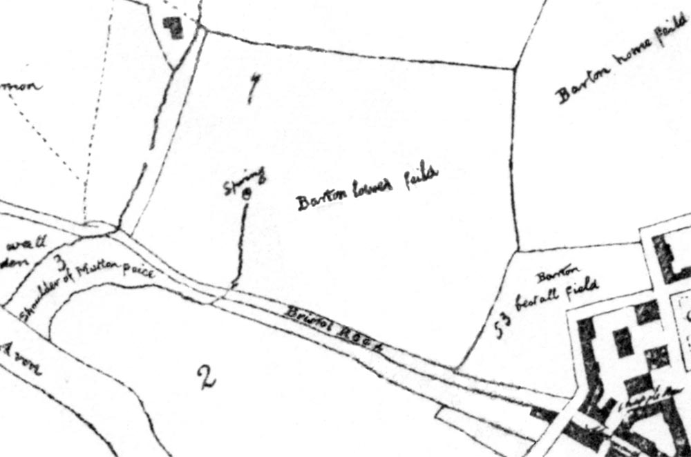
The west side of Queen Square is visible lower right, recently built. Charlotte Strret was to be later built on no. 53 Barton Bestall Field.
.JPG)
Map
of Bath 1742 by Thomas Thorpe showing Queens Square and the Bristol Road.
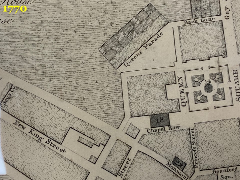
Map
of Bath 1770 by Thomas Thorpe showing Queens Parade (built 1768 instead of an intended Assembly Rooms) and Queens Square.
.JPG)
Map
of Bath 1786
.jpg)
Map
of Bath 1786 by Harcourt Masters. Someone has later sketched in proposed route of Charlotte Street from corner of Queens Parade to Monmouth Place. There are already a number of houses and buildings along Monmouth Place. At one time the builders, Jelly and Sainsbury`s had Timber Stores on this Street where Charlotte Street wasa later to be built. Amongst the many buildings they designed and constructed was the old King Edwards School on Broad Street (built in 1752).
.JPG)
A later, more detailed Maps
of Bath dated 1795 by C. Harcourt Masters which shows the large building and workshops of Jelly and Fisher on Monmouth Place, where Davies, the Decorators Merchants has been based for the last 80 years. The area described as a Coal Yard was originally intended as the site of Barton Farm House, which was to replace the original building where Jolly`s now stands, but never built.
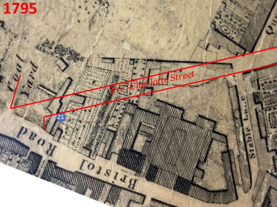
The route Charlotte Street was to take is superimposed on this map of 1795.
.JPG)
A Map
of Bath dated 1810 which relates to a proposed route of a road that was never built.
.JPG)
A Map
of Bath dated 1813 showing the area where Charlotte Street was later to be built.
.JPG)
Map
of Bath 1817
.JPG)
Maps
of Bath 1820
.JPG)
Map
of Bath 1825
.jpg)
Map
of Bath 1825 which shows the proposed route of Charlotte Street which would have linked Queens Square with Bristol Road.
.jpg)
Map
of Bath 1832
.JPG)
Map
of Bath 1837 with Charlotte Street clearly shown.
.jpg)
Map
of Bath 1845 with Charlotte Street clearly shown, with some of the first houses to be seen on the north side.
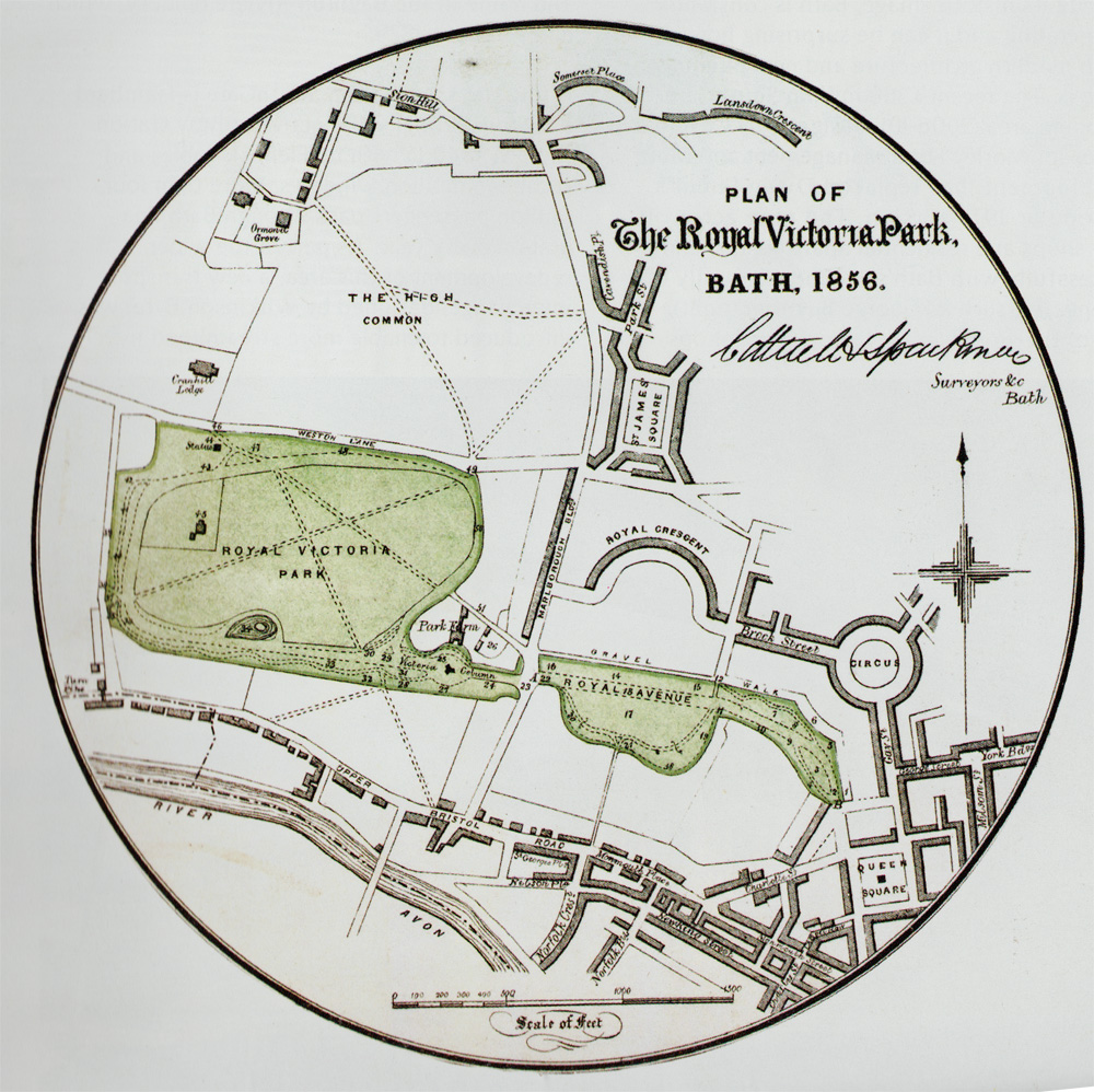
Plan of Victoria Park, with Charlotte Street in the bottom right hand corner in its unfinished state.
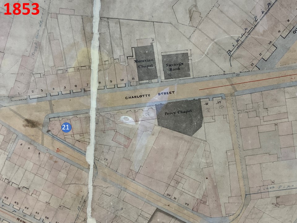
Map
of Bath 1853 by J.H. Cottrell with additions made at a later date.
Map
of Bath 1870 showing thcompleted North Side and a gap on the southern side where Thomas Shackell was to build the rest of the Street soon after in that year.
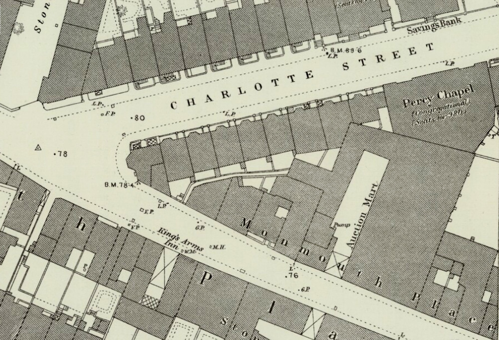
The large scale Ordnance Survey Map
of Bath for 1883 which shows in detail the properties in Charlotte Street and Monmouth Place.
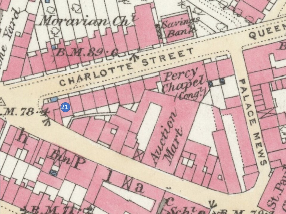
The large scale Ordnance Survey Map
of Bath for 1883 in colour.
.JPG)
The large scale Ordnance Survey Map
of Bath for 1903
The large scale Ordnance Survey Map
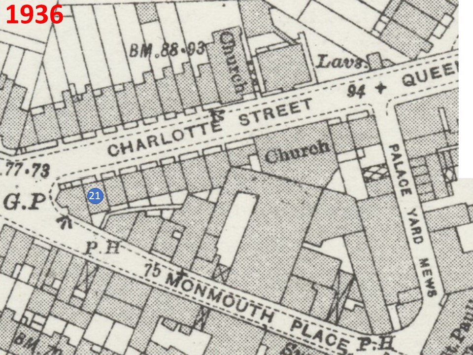
of Bath for 1936.
The large scale Ordnance Survey Map
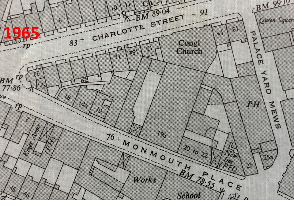
of Bath for 1965.
.JPG)
The large scale Ordnance Survey Map
of Bath for 1976 that reveals that nos. 18/18a Monmouth Place have been demolished and is now a car park.
.jpg)
An Aerial view of the area in 1920 that shows nos. 18/18a Monmouth Place at the bottom of the photograph were still there.
.jpg)
An Aerial view of the area today that shows nos. 18/18a Monmouth Place had long since been demolished.
.jpg)
An Aerial view of the area today that shows nos. 18/18a Monmouth Place had long since been demolished and vehicles were parked in the space where they once stood.
Click on History of Charlotte Street Car Park for PDF